Welcome to National Parks of Nepal.

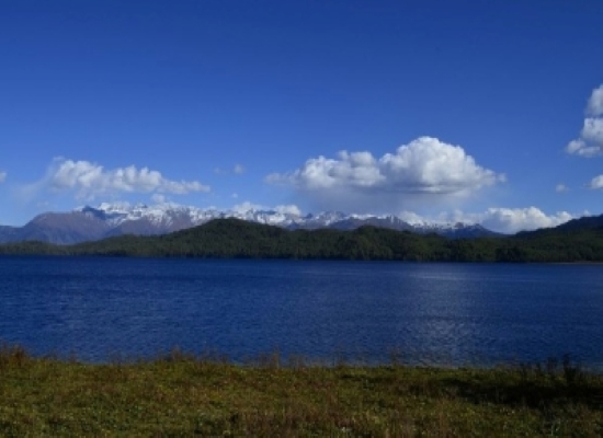
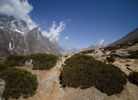
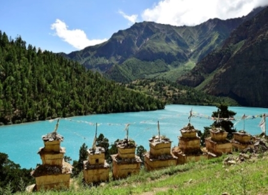
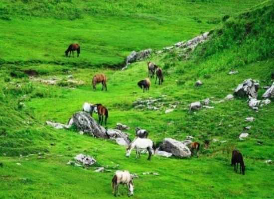
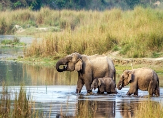
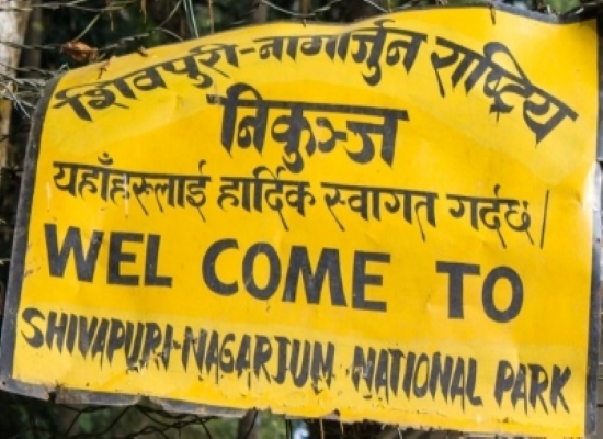
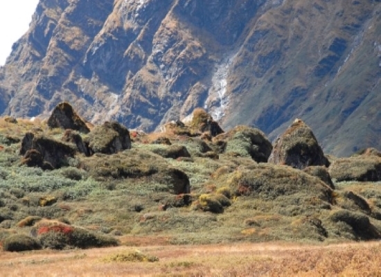
Government of Nepal has established a network of 20 Protected Areas since 1973 consisting of 12 National Parks. Chitwan National Park is the first national parks of Nepal and Shey-phoksundo National Park is the largest among them. There are 10 national Parks before promotion of Parsa and Shuklaphanta Wildlife Reserves. They are Chitwan National Park, Banke national Park, Bardiya Nationl Park, Lantang National Park, Sagarmatha National Park, Shey-phoksundo NationalPark, Rara National Park, Makalu-Barun National Park, Shivapuri-Nagarjun National Park, Khaptad National Park. According to area Rara National Park is the smallest national park of Nepal.In 2017 the Shuklaphanta and Parsa Wildlife Reserves were upgraded to National Park.

danfe

Bardiya National Park

spotted-dear

Bardiya National Park (Nepali: बर्दिया राष्ट्रिय निकुञ्ज; also spelled Bardia, is a protected area in Nepal that was established in 1988 as Royal Bardia National Park. Covering an area of 968 km2 (374 sq mi) it is the largest and most undisturbed national park in Nepal's Terai, adjoining the eastern bank of the Karnali River and bisected by the Babai River in the Bardiya District. Its northern limits are demarcated by the crest of the Siwalik Hills. The Nepalgunj-Surkhet highway partly forms the southern boundary, but seriously disrupts the protected area. Natural boundaries to human settlements are formed in the west by the Geruwa, a branch of the Karnali River, and in the southeast by the Babai River.

Together with the neighboring Banke National Park, the coherent protected area of 1,437 km2 (555 sq mi) represents the Tiger Conservation Unit (TCU) Bardia-Banke that extends over 2,231 km2 (861 sq mi) of alluvial grasslands and subtropical moist deciduous forests.


Chitwan National Park

Rhinos

Chitwan National Park (Nepali: चितवन राष्ट्रिय निकुञ्ज) is the first national park in Nepal. It was established in 1973 and granted the status of a World Heritage Site in 1984. It covers an area of 932 km2 (360 sq mi) and is located in the subtropical Inner Terai lowlands of south-central Nepal in the districts of Nawalpur, Parsa, Chitwan andMakwanpur. In altitude it ranges from about 100 m (330 ft) in the river valleys to 815 m (2,674 ft) in the Churia Hills.

In the north and west of the protected area the Narayani-Rapti river system forms a natural boundary to human settlements. Adjacent to the east of Chitwan National Park is Parsa National Park, contiguous in the south is the Indian Tiger Reserve Valmiki National Park. The coherent protected area of 2,075 km2 (801 sq mi) represents the Tiger Conservation Unit (TCU) Chitwan-Parsa-Valmiki, which covers a 3,549 km2 (1,370 sq mi) huge block of alluvial grasslands and subtropical moist deciduous forests.


Lantang National Park

Langtang National Park was established in 1976 as Nepal's first Himalayan national park and the country's fourth protected area. It exceeds an altitudinal range of 6,450 m (21,160 ft) and covers an area of 1,710 km2 (660 sq mi) in the Nuwakot, Rasuwa and Sindhulpalchok Districts of the central Himalayan region encompassing 26 village communities. In the north and east it is linked with Qomolangma National Nature Preserve in Tibet Autonomous Region. The western boundary follows the Bhote Koshi and the Trishuli river. The southern border lies 32 km (20 mi) north of the Kathmandu Valley.

The high altitude sacred Gosainkunda lake is located at an altitude of 4,300 m (14,100 ft) inside the park. The Dorje Lakpa range at 6,988 m (22,927 ft) bisects the park from west–east to south–east. The summit of Langtang Lirung (7,245 m (23,770 ft)) is the highest point in the park.

Langtang National Park is part of the Sacred Himalayan Landscape.


Rara National Park

rara-lake

Rara National Park is a protected area in the Himalayas of Nepal and was established in 1976. Covering an area of 106 km2 (41 sq mi) in the Mugu and Jumla districts, it is the country's smallest national park. Its main feature is Rara Lake at an altitude of 2,990 m (9,810 ft).[1] The park was established to protect the unique flora and fauna of the Humla–Jumla Region of Nepal.

The park ranges in elevation from 2,800 m (9,200 ft) to 4,039 m (13,251 ft) at Chuchemara Peak on the southern side of Rara Lake. On the northern side, the peaks of Ruma Kand and Malika Kand frame the alpine freshwater lake, which is the largest lake in Nepal with a surface of 10.8 km2 (4.2 sq mi) and a maximum depth of 167 m (548 ft). It is oval-shaped with an east–west axis, a length of 5 kilometres (3.1 mi) and a width of 3 km (1.9 mi) draining into the Mugu Karnali River via Nijar Khola.

Rara National Park is managed by the Department of National Parks and Wildlife Conservation and protected with the assistance of the Nepal Army.


Sagarmatha National Park

way-to-sagarmatha

Sagarmāthā National Park is a national park in the Himalayas of eastern Nepal that is dominated by Mount Everest. It encompasses an area of 1,148 km2 (443 sq mi) in the Solukhumbu District and ranges in elevation from 2,845 to 8,848 m (9,334 to 29,029 ft) at the summit of Mount Everest. In the north, it shares the international border with the Qomolangma National Nature Preserve of Tibet. In the east it is adjacent to Makalu Barun National Park, and in the south it extends to Dudh Kosi river. It is part of the Sacred Himalayan Landscape.

Sagarmāthā is a Nepali word derived from सगर् sagar meaning "sky" and माथा māthā meaning "head". The protected area has been identified as an Important Bird Area by BirdLife International.


Shey Phoksundo National Park

phoksundo-lake

Shey Phoksundo National Park (Nepali: शे-फोकसुण्डो She-Phoksundo) is the largest and only trans-Himalayan national park in Nepal. It was established in 1984 and covers an area of 3,555 km2 (1,373 sq mi) in the districts of Dolpa and Mugu in the Mid-Western Region, Nepal. The protected area ranges in elevation from 2,130 to 6,885 m (6,988 to 22,589 ft). Phoksundo Lake is the park's prominent feature, located at an elevation of 3,612 m (11,850 ft).
The park's headquarters are in Palam, Dolpa District.


Khaptad National Park

horses

Khaptad National Park is a protected area located in the Far-western region of Nepal. The park was gazetted in 1984 covering an area of 225 sq. km. The area of buffer zone is 216 sq.km. The park is the only mid-mountain national park in western Nepal, representing a unique and important ecosystem. The late Khaptad Swami moved to the area in 1940's to meditate and worship. He spent about 50 years as a hermit and became a renowned spiritual saint.


Banke National Park

Bahrasinga

Banke National Park is located in the Mid-Western Region, Nepal and was established in 2010 as Nepal’s tenth national park after its recognition as a "Gift to the Earth".The protected area covers an area of 550 km2 (210 sq mi) with most parts falling on the Churia range. The park is surrounded by a buffer zone of 344 km2 (133 sq mi) in the districts of Banke, Salyan and Dang. Together with the neighboring Bardia National Park, the coherent protected area of 1,518 km2 (586 sq mi) represents the Tiger Conservation Unit (TCU) Bardia-Banke.


Parsa National Park

elephant

Parsa National Park is a protected area in the Inner Terai lowlands of south-central Nepal. It covers an area of 627.39 km2 (242.24 sq mi) in the Parsa, Makwanpur and Bara districts and ranges in altitude from 435 m (1,427 ft) to 950 m (3,120 ft) in the Siwalik Hills. It was established as a wildlife reserve in 1984. A bufferzone declared in 2005 comprises 285.3 km2 (110.2 sq mi).[1] In 2015, the protected area has been extended by 128 km2 (49 sq mi).Since 2017, it has the status of a National Park.
In the north of the protected area the Rapti River and Siwalik Hills form a natural boundary to human settlements. In the east it extends up to the Hetauda – Birgunj highway. In the south, a forest roads demarcates the boundary. Adjacent to the west is Chitawan National Park. Together with the Indian Tiger Reserve Valmiki National Park, the coherent protected area of 2,075 km2 (801 sq mi) represents the Tiger Conservation Unit (TCU) Chitwan-Parsa-Valmiki, which covers a 3,549 km2 (1,370 sq mi) block of alluvial grasslands and subtropical moist deciduous forests. Before being converted to a protected area, the region used to be a hunting ground of the ruling class.


Shivapuri Nagarjun National Park

borad

Shivapuri Nagarjun National Park is the ninth national park in Nepal and was established in 2002. It is located in the country's mid-hills on the northern fringe of the Kathmandu Valley and named after Shivapuri Peak of 2,732 m (8,963 ft) altitude. It covers an area of 159 km2 (61 sq mi) in the districts of Kathmandu, Nuwakot and Sindhupalchowk, adjoining 23 Village Development Committees.[1] In the west, the protected area extends to the Dhading District.


Shuklaphanta National Park

rani-taal

Shuklaphanta National Park is a protected area in the Terai of the Far-Western Region, Nepal, covering 305 km2 (118 sq mi) of open grassland, forests, riverbeds and tropical wetlands at an altitude of 174 to 1,386 m (571 to 4,547 ft). It was gazetted in 1976 as Royal Shuklaphanta Wildlife Reserve. A small part of the reserve extends north of the East-West Highway to create a corridor for seasonal migration of wildlife into the Sivalik Hills. The Syali River forms the eastern boundary southward to the international border with India, which demarcates the reserve’s southern and western boundary.

The Indian Tiger Reserve Kishanpur Wildlife Sanctuary is contiguous in the south; this coherent protected area of 439 km2 (169 sq mi) represents the Tiger Conservation Unit (TCU) Sukla Phanta-Kishanpur, which covers a 1.897 km2 (0.732 sq mi) block of alluvial grasslands and subtropical moist deciduous forests.

The protected area is part of the Terai-Duar savanna and grasslands ecoregion and is one of the best-conserved examples of floodplain grassland. It is included in the Terai Arc Landscape.


Makalu Barun National Park

Bushes-hills

Makalu Barun National Park is a national park in the Himalayas of Nepal that was established in 1992 as eastern extension of Sagarmatha National Park. It is the world's only protected area with an elevation gain of more than 8,000 m (26,000 ft) enclosing tropical forest as well as snow-capped peaks. It covers an area of 1,500 km2 (580 sq mi) in the Solukhumbu and Sankhuwasabha Districts, and is surrounded by a bufferzone to the south and southeast with an area of 830 km2 (320 sq mi).
The rugged summits of Makalu, with 8,463 m (27,766 ft) the fifth highest mountain of the world, Chamalang (7,319 m (24,012 ft)), Baruntse (7,129 m (23,389 ft)) and Mera (6,654 m (21,831 ft)) are included in the national park. The protected area extends to about 66 km (41 mi) from west to east and to about 44 km (27 mi) from north to south. From the Arun river valley in the southeast, located at altitudes of 344–377 m (1,129–1,237 ft), elevation gains about 8,025 m (26,329 ft) to the peak of Makalu. The national park shares the international border with the Qomolangma National Nature Preserve of the Tibet Autonomous Region in the north.
The protected area is part of the Sacred Himalayan Landscape.

National Parks of Nepal with some more information

National Parks Area (sq.km) Extension Buffer Zone(sq.km) Established Date
Chitwan National Park 932 km2 Chitwan, Parsa, Nawalparasi and Makawanpur 729.37 km2 2030(1973 A.D.)
Banke National Park 550 km2 Banke, Dang and Salyan 243.5 km2(2061) 2067(2010 A.D.)
Bardiya National Park 968 km2 Bardiya 507 km2 2032(1976 A.D.)
Parsa National Park 627.39 km2 Bara, Parsa, Chitwan and Makawanpur 285.3 km2(2062) 2040/2072(1984 A.D.)
Rara National park 106 km2 Mugu and Jumla 198 km2(2063) 2032(1976 A.D.)
Sagarmatha National Park 1148 km2 Solukhumbu 257 km2(2058) 2032(1976 A.D.)
Makalu Barun National Park 1500 km2 Shankhuwashabha 830 km2(2055) 2048(1991 A.D.)
Shivapuri Nagarjun National Park 159 km2 Kathmandu, Nuwakot, Sindhupalchowk and Dhading 118.61 km2(2072) 2058(2002 A.D.)
Shuklaphanta National Park 305 km2 Kanchanpur 243.5 km2(2061) 2031(1976 A.D.)
Lantang National Park 1710 km2 Rasuwa, Nuwakot and Sindhupalchowk 420 km2(2055) 2032(1976 A.D.)
Shey-phoksundo National Park 3555 km2 Dolpa and Mugu 1349 km2(2055) 2040(1984 A.D.)
Khaptad National Park 225 km2 Bajhang, Bajura, Doti and Achham 216 km2(2063) 2040(1984 A.D.)

Protected Areas